Floodplain & Tornado Path Risk Mapping for Oklahoma Underwriters
Introduction
Understanding flood and tornado risks in Oklahoma is crucial for underwriters seeking to enhance policy accuracy and minimize losses. These extreme weather events can have devastating impacts on communities, compromising not only personal safety but also financial stability. As such, incorporating AI-driven geospatial analytics into the risk assessment process represents a transformative tool for underwriters. The adoption of precise risk mapping enabled by advanced technology allows underwriters to identify high-risk areas and structure better-suited insurance policies, thereby fulfilling the dual objectives of customer protection and business sustainability.
What are Floodplain and Tornado Path Risks in Oklahoma?
Understanding Floodplain Risks
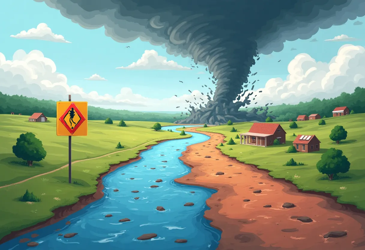
Floodplains are low-lying areas adjacent to rivers and streams that are prone to flooding. These geographic features are defined by their susceptibility to periodic inundation, influenced by factors such as rainfall, topography, soil type, and urban development. Major floods throughout Oklahoma's history have highlighted these risks, with devastating consequences for affected communities. The 2007 flood in Oklahoma City, for instance, led to significant property damage and loss of life, emphasizing the need for comprehensive floodplain risk assessments.
Assessing floodplain risks involves analyzing regional rainfall patterns, historical flooding events, and climate change projections. By understanding these elements, underwriters can develop more accurate flood risk profiles for properties, enabling them to offer appropriate coverage levels and premium rates.
Analyzing Tornado Path Risks
Oklahoma is renowned for its high incidence of tornadoes, attributed to its geographical location in an area commonly called "Tornado Alley." These powerful storms typically occur during the spring months but can arise at any time throughout the year. Analyzing tornado path risks requires a thorough understanding of tornado occurrence, storm paths, and associated damages to properties and businesses. Tornadoes can result in catastrophic destruction, and their unpredictable nature makes it essential for insurers to rely on data-driven analysis.
The history of tornadoes in Oklahoma reveals both the frequency and severity of these storms. For instance, the May 1999 tornado in Moore, Oklahoma, was one of the most powerful in U.S. history and resulted in extensive property damage and loss of life. Recognizing the risks associated with tornadoes allows underwriters to assess potential losses and implement strategies for client protection.
The Importance of Geographic Understanding
The geography of Oklahoma plays a vital role in determining areas at risk for both flooding and tornadoes. Factors such as elevation, proximity to water bodies, and urbanization directly influence how flooding occurs and how tornado paths are formed. For instance, regions situated in river valleys face greater flood risk, while open plains are more susceptible to tornado touchdowns.
Understanding local topography is essential in risk assessments. By leveraging geographic data, underwriters can make informed decisions about risk areas and tailor insurance offerings based on these assessments. This geographic insight not only enhances policy accuracy but also provides clients with essential knowledge about their risk exposures.
How Does AI-Driven Geospatial Analytics Improve Risk Mapping?
The Role of AI in Analyzing Geospatial Data
AI-driven geospatial analytics integrates advanced algorithms to analyze vast amounts of geospatial data. This technology processes data from multiple sources, including satellite imagery, weather patterns, topographical maps, and historical data about weather events. The role of AI in this context is paramount—it enables underwriters to generate detailed risk assessments with unprecedented precision.
For example, satellite imagery captures real-time changes in land use and vegetation, helping to identify potential floodplain areas. Weather pattern analysis enables better predictions of future flood events and tornado occurrences. AI algorithms can identify patterns that may escape traditional analytical methods, leading to improved risk mapping.
Benefits of AI for Underwriters
The incorporation of AI into underwriting processes provides several advantages. Enhanced precision in risk assessment allows underwriters to tailor policies more effectively. By analyzing real-time data, underwriters can adjust insurance premiums and coverages based on current risk levels, promoting financial stability for both the insurer and the insured.
In addition to enhanced risk assessment, AI empowers underwriters with real-time data processing and analytics. Responding swiftly to changing conditions ensures that both underwriters and policyholders remain informed and protected against emerging risks.
How Can Oklahoma Underwriters Leverage Floodplain and Tornado Path Risk Mapping?
Integrating Risk Mapping into Underwriting Processes
To leverage AI-driven insights effectively, Oklahoma underwriters should integrate risk mapping into their underwriting processes. This begins by collecting and analyzing geospatial data, which can be used to assess the risks associated with each property more effectively. Risk maps provide a visual representation of floodplains and tornado-prone areas, aiding underwriters in evaluating policy exposures accurately.
Once the risks are quantified, underwriters can tailor insurance policies based on detailed assessments, offering coverage that directly addresses identified vulnerabilities. This level of customization not only enhances customer satisfaction but also reduces the likelihood of financial losses associated with claims from unforeseen natural disasters.
Enhancing Client Communication and Education
Effective communication with clients is essential for establishing solid relationships built on trust. Underwriters can use accurate risk assessments to inform clients about their specific risks and insurance coverage options. By educating clients on the factors that impact their policies, such as floodplain and tornado path risks, underwriters can empower them to make informed decisions regarding their insurance needs.
Providing transparent insights into risk assessments not only helps to build trust but also encourages clients to engage in proactive risk management strategies. By making clients aware of potential hazards and necessary precautions, underwriters can foster a collaborative approach to managing risk.
Risk Mitigation Strategies Based on Mapping Insights
Basing risk mitigation strategies on comprehensive mapping insights is crucial for protecting clients and minimizing losses. Underwriters can recommend specific property improvements, such as elevating homes in flood-prone areas or implementing storm-resistant construction practices in tornado-prone regions.
Additionally, community-based safety initiatives can be developed based on mapping insights. Collaborating with local governments and organizations to promote awareness campaigns and preparedness efforts can significantly enhance community resilience and reduce the overall impact of flooding and tornadoes.
What Future Innovations are Emerging in Risk Mapping?
Advances in AI and Machine Learning
As technology continues to evolve, ongoing advancements in AI and machine learning promise to further enhance risk mapping accuracy. These technologies can analyze even larger datasets at an unprecedented speed, identifying emerging risks and trends that may influence underwriting decisions. Predictive analytics, which utilizes historical data trends to forecast future occurrences and impacts, is becoming increasingly relevant in the insurance industry.
By embracing these innovations, underwriters can enhance their risk assessments, making them more accurate and reliable. Considering future developments in machine learning helps underwriters stay agile in adapting to a rapidly changing risk landscape.
Integration with IoT and Real-Time Monitoring
The potential integration of IoT (Internet of Things) devices with risk mapping represents a significant advancement in data collection and analysis. Real-time monitoring through IoT devices—such as flood sensors and weather tracking tools—can provide immediate data feeds to underwriters, allowing for swift adaptations to risk assessments and policy adjustments. This proactive approach enhances risk management capabilities and client protection during adverse weather conditions.
Successful examples of IoT in risk management highlight the importance of real-time data in improving response strategies. By leveraging these technologies, underwriters can reposition themselves for unforeseen challenges and rapidly evolving climate-related risks.
Challenges and Considerations for Underwriters
Despite the advantages of AI-driven geospatial analytics, it is essential for underwriters to recognize the limitations associated with current technology. While data accuracy is critical, ethical considerations surrounding privacy and data usage must also be addressed. As underwriters gather more data to enhance their risk assessments, they must balance the need for information with respecting individuals' privacy rights.
Furthermore, adopting new technologies involves a learning curve, and underwriters should invest in training and education to maximize the benefits of AI and machine learning in their operations. By acknowledging these challenges, underwriters can navigate the complexities of risk mapping effectively.
Conclusion
In conclusion, understanding floodplain and tornado path risk mapping is vital for Oklahoma underwriters aiming to enhance policy accuracy and reduce losses. Embracing AI-driven geospatial analytics empowers underwriters to develop sophisticated risk assessments that not only protect their clients but also improve operational efficiency. As advancements in technology continue to emerge, ongoing education and innovative practices will be key to succeeding in this dynamic landscape. For further insights into the intersection of AI and insurance processes, we invite you to explore our blog on AI‑Driven Vehicle Inspection Automation for Rural Oklahoma Markets. To learn more about how our solutions can support your underwriting process, contact us today.